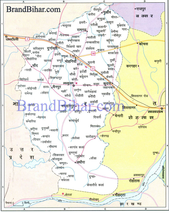
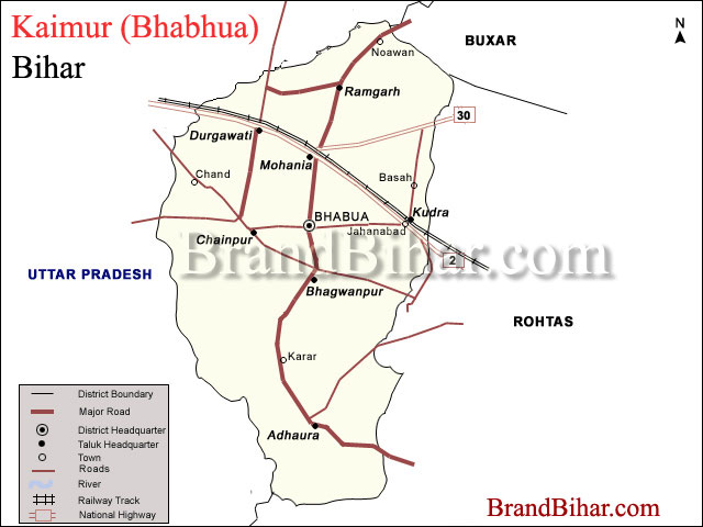
Map of Bhabhua

Kaimur (Bhabhua) Geographically, Kaimur (Bhabhua) district covers an area of about 340447 Hectares and can be divided into two parts viz. (i) Hilly area and (ii) Plain area. The hilly area comprises of Kaimur plateau. The plain area on the western side is flanked by the rivers The Karmanasha and the Durgawati. The Kudra river lies on it eastern side. The district of Buxar of Bihar State and the district of Ghazipur of U.P. State bound it on the North. On the south is the district of Garhwa of Jharkhand State and on the West is the district of Chandauli and Mirjapur of the U.P. State. On the East is district of Rohtas of Bihar State. The district has close linkage with the history of Shahabad, which was its parent district also. The old district of Shahabad had four subdivisions of which Bhabua was one. The present district of Kaimur has been formed from the whole of this Bhabua subdivision. Click on the Map of Kaimur (Bhabhua) to see the largeView of Kaimur (Bhabhua) Map
Climate The climate of the district is somewhat extreme in nature, i.e., quite hot during the summer and fairly cold during the winter. January is the coldest month when the mean minimum temperature comes down to approximately 4 degree C.. The temperature starts rising from March and reaches its peak in May when the mercury touches about 450C. Rain starts sometime in mid June and lasts till mid September. The district gets easterly winds from June to September, and from October to May wind direction reverses. Maximum rains occur during the months of July and August (289 mm). Sometimes winter rains occur in Jan-February. River Originating from the Kaimur hills, the river Karmanasha passes through Mirzapur district of U.P. and forms the western boundary of the district for about 170 Kms. The river Kudra, which forms eastern boundary separating Rohtas district, is a branch of the river Dhoba rising in Kaimur Plateau South-West of Tilauthu, and ultimately joins the river Karmanasha. The River Durgawati originates from Kaimur hills and flows in the northern direction. It is joined by the Kudra River before it merges finally into the river Karmanasha. The river Durgawati is perennial in nature and inundates a large area of land during heavy rains. Forest The alluvial plain extending up to the foothills of Kaimur ranges is extensively cultivated. Rice, wheat, pulses are the chief crops and the area is dotted with bamboo clumps and mango orchards. The Forests found in the Kaimur hills have suffered indiscriminate felling of trees in the recent past. The plateau is generally covered with long grasses, viz. Kush and khas. Sal trees of poor quality and vast stretches of bamboo are also found. Firewood, Tendu leaf and Chiraunji are the important forest products. Irrigation Durgawati and the Karmanasha rivers are the perennial sources of surface water. A high level canal from Indrapuri (Dehri) has been irrigating the southern parts of this district. The canal is about 84 Kms long and irrigates about 34000 hectares of land during Kharif season and about 9000 hectares of land during Rabi season. The southern part of Kaimur district has a number of canal systems such as Durgawati Main Canal, Garachaube canal etc.
Out of the total geographical area of the Kaimur district 31.22 % is covered by the forest, mainly in Adhaura, Chainpur and Bhagwanpur blocks. Paddy, Wheat, Barley and Maize are the main cereal crops of the district. Among pulses, gram occupies the maximum area of cultivation, followed by Mansur, Arhar, Moong and Urod. Sugar cane and potatoes are the main cash crops. Mines and Minerals Sands of the Durgawati and the Kudra River are exploited as building material. The hilly tracts of Kaimur ranges are a part of very old Vindhyan system of mountains; hence, there is possibility of limestone, sulpher and pyretic iron ores to be found here. The mineral wealth needs more study and is yet to be explored properly. Industrialisation The district is scantily industrialised. A few private rice mills, however, are found here mainly in Mohania Subdivision. Mohania block in credited with a DRDA sponsored Dairy and a BSTDC hotel known as, the Kaimur Hotel. Transport Facilities NH 2 (G.T. Road) crosses through the center of the district from Karmanasha to Kudra for about 50 km. NH 30 originates from it near Mohania and connects this district with the capital Patna via Arah. Apart from these, there are also a few State Highways in the district. Commerce Banarasi Sari, Silk, Kaleen, Dari and Agricultural produces are the main articles, which are traded in and out of the district. Electricity and Energy Pusauli power station is being constructed at a distance of 8-10 Kms form the Sub-divisional Headquarters of Mohania. The possibility of tapping solar energy is also great in the district.
Places of Religious, Historical & Archeological Importance Adhaura Baidyanath Bhabua Bhagwanpur Chainpur Chorghatia Durauli Ramgarh
|


